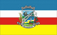
Araranguá
 |
 |
Until the 18th century, the city was inhabited mostly by Carijós and Kaingang Indians. These ethnics groups disappeared after the arrival of the first Europeans settlers.
On 11 February 1728, was started the opening of the Caminho dos Conventos way that linked Morro dos Conventos ("Convents Mountain") to Curitiba. This way became used mostly by the tropeiros, who carried cattle from Rio Grande do Sul to São Paulo. Araranguá became a waypoint for those between Viamão (former capital of Rio Grande do Sul) and Lages (in the top of the Planalto Serrano).
The first to arrive in Araranguá region were the Portugueses, who came from Laguna in the beginning of the 19th century. They first settled in the Morro dos Conventos. Later, Italian, German, Polish and Spanish immigrants and the African slaves arrived in the city. In 1816 was inaugurated in the village of Canjicas the first chapel in the region. In 1864 was created the first church within the current city of Araranguá.
The city was founded 3 April 1880, and was named Araranguá after the Araranguá River. The village was promoted to the condition of city in 1921.
Along the 20th century the city underwent some dismemberments. The city of Criciúma emancipated in 1925 followed by Turvo (1948), Sombrio (1953), Maracajá (1967) and Balneário Arroio do Silva (1997).
Map - Araranguá
Map
Country - Brazil
Currency / Language
| ISO | Currency | Symbol | Significant figures |
|---|---|---|---|
| BRL | Brazilian real | R$ | 2 |
| ISO | Language |
|---|---|
| EN | English language |
| FR | French language |
| PT | Portuguese language |
| ES | Spanish language |


